
DATAAD INDUSTRY VOICES | EXCLUSIVE INTERVIEW
When GPS Can't Be Trusted: The Hidden Challenge of Autonomous Navigation
Navigation engineer Predrag Milicevic explains why reliable autonomous systems need more than accurate positioning — they must also recognize when their navigation information can no longer be trusted.
Beyond AI: The Navigation Problem
Artificial intelligence is often at the center of discussions about autonomous vehicles, drones and unmanned vessels. But behind every autonomous system lies a more fundamental engineering challenge: knowing where the machine is, where it is moving, and whether that information is reliable.
A drone may have advanced AI capabilities. An unmanned vessel may use sophisticated automation. Yet neither can operate safely if its navigation system provides incorrect information without recognizing the problem.
For navigation engineer Predrag Milicevic, this distinction between accuracy and reliability is one of the most important and frequently underestimated challenges in autonomous technology.
In an exclusive email interview with DATAAD, Milicevic discusses the limitations of satellite navigation, the importance of inertial navigation systems, the complexities of combining different sensors, and the need for testing under real operating conditions.
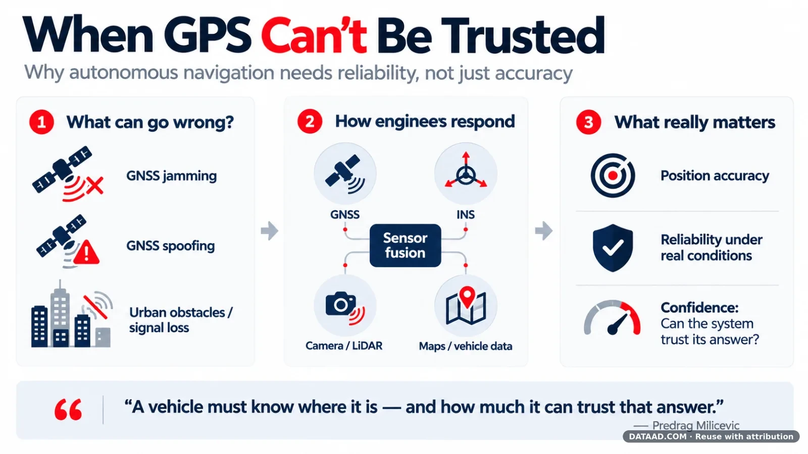
"An autonomous vehicle needs to know where it is. Equally important, it needs some indication of how much it can trust that answer."
— Predrag Milicevic
1. The Real Challenge: Navigation Outside Ideal Conditions
DATAAD: What are the biggest navigation challenges facing autonomous vehicles, drones, and unmanned vessels today?
Predrag Milicevic: One of the biggest challenges is maintaining reliable navigation when operating conditions are far from ideal.
GNSS, or Global Navigation Satellite Systems, is an excellent technology, but its signals cannot always be relied upon. In urban environments, near obstacles or under radio-frequency interference, positioning quality can deteriorate quickly.
Intentional jamming and spoofing create additional risks. Jamming interferes with satellite signals, while spoofing can cause a receiver to calculate an incorrect position using misleading signals.
Different autonomous platforms also face different navigation problems. A slow-moving ground vehicle in a city, a fixed-wing unmanned aircraft and an unmanned vessel operate under very different physical conditions.
A navigation solution that works well for one platform may not be suitable for another.
Milicevic argues that engineers sometimes place too much emphasis on accuracy measurements obtained under favorable conditions.
What matters just as much is how a navigation system behaves when those conditions change — and whether it can recognize that its position estimate is becoming less dependable.
2. What Happens When GNSS Is Lost or Manipulated?
DATAAD: What happens when GNSS signals are jammed, spoofed, or unavailable?
Predrag Milicevic: The consequences depend heavily on how the navigation system was designed.
A system that relies primarily on GNSS may encounter serious problems when satellite signals disappear.
Spoofing can be particularly dangerous because a receiver may continue producing position data that appears perfectly valid even though it is wrong.
Inertial Navigation Systems, or INS, offer an important alternative. Using inertial sensors, they estimate movement and orientation without requiring continuous satellite signals.
However, INS is not a perfect replacement for GNSS.
Inertial sensors have measurement errors, and those errors accumulate over time. The rate at which a navigation solution drifts depends on sensor quality, calibration, algorithms and the motion of the vehicle.
Milicevic views INS as a fundamental part of navigation architecture rather than merely a backup activated when GNSS disappears.
INS can also provide an independent reference for checking whether GNSS measurements are consistent with the vehicle's motion.
"So the question is not simply whether navigation continues without GNSS. It is how long it remains useful, and with what accuracy."
3. Why Good Sensors Are Not Enough
DATAAD: What do developers of autonomous systems often underestimate about navigation reliability?
Predrag Milicevic: Developers often underestimate the difficulty of achieving reliable navigation outside controlled conditions.
High-quality sensors are important, but they represent only part of the solution.
A system may use a capable inertial measurement unit (IMU) and an accurate GNSS receiver yet still deliver disappointing results in actual operation.
Sensor calibration, timing, mechanical mounting, vibration and vehicle dynamics all influence navigation performance.
The algorithms responsible for combining these measurements must also remain dependable across changing operating conditions.
Milicevic emphasizes the importance of comparing simulation results with physical testing.
Problems that appear insignificant in simulations may become serious during actual vehicle testing. The reverse can also occur.
For this reason, he does not consider simulation alone sufficient for validating a navigation system.
Another critical distinction is the difference between accuracy and reliability.
A system may provide extremely accurate position estimates most of the time. But what happens when one sensor begins supplying incorrect information?
The engineering challenge is not only to calculate an accurate position. It is also to determine when that calculation should no longer be trusted.
4. The Future Is Sensor Fusion, Not One Perfect Technology
DATAAD: How are alternative positioning and navigation technologies evolving?
Predrag Milicevic: Several technologies are improving the ability of navigation systems to operate when GNSS becomes unreliable.
Controlled Reception Pattern Antennas (CRPA) can improve resilience against interference and jamming.
Other developments include visual navigation, LiDAR-based localization, terrain matching and map-based positioning.
These approaches can provide additional navigation information when satellite positioning is unavailable.
However, Milicevic does not expect any single technology to become a universal replacement for GNSS.
Cameras can struggle with poor lighting or limited visibility. Map-based navigation depends on the availability and accuracy of reference data. Every navigation method has limitations.
A more practical approach is to combine multiple information sources around an inertial navigation system.
For example:
- Ground vehicles: Wheel-speed measurements and vehicle-motion constraints can support inertial navigation.
- Aircraft: Airspeed and barometric measurements provide additional information.
- Autonomous platforms: Cameras, LiDAR and map matching can provide positioning corrections when conditions allow.
But connecting more sensors does not automatically produce a better navigation system.
Some measurements can improve a position estimate under normal conditions while making it worse under different circumstances.
Effective sensor fusion therefore requires algorithms capable of deciding when a measurement should be accepted, questioned or rejected.
This ability to evaluate information quality is central to robust autonomous navigation.
5. The Next Five to Ten Years: More Adaptive Navigation
DATAAD: Where do you see navigation technology heading over the next five to ten years?
Predrag Milicevic: Navigation systems are likely to become more adaptive and less dependent on any single positioning technology.
Artificial intelligence may contribute to this development, particularly by helping evaluate sensor information and adapt to changing operating conditions.
Better inertial sensors will continue to improve performance, but Milicevic also sees substantial opportunities in using existing sensors and information more effectively.
This is especially important for smaller autonomous platforms where size, electrical power consumption and cost impose practical limits.
Installing increasingly expensive sensors is not always the best solution.
Improving the way available information is processed and combined can sometimes deliver more practical benefits.
Visual navigation, LiDAR and map-based positioning are also likely to become more common as supplementary navigation references.
The challenge will be ensuring that these different technologies continue working together when some measurements become temporarily unavailable or unreliable.
Ultimately, future navigation systems should be evaluated not only by the accuracy they achieve under ideal conditions, but also by how they respond when the environment becomes unpredictable.
DATAAD Perspective: Reliability Before Autonomy
The interview highlights an important distinction in the development of Physical AI.
Artificial intelligence may improve how machines perceive their surroundings, make decisions and perform complex tasks. But those capabilities depend on trustworthy information about the physical world.
For autonomous vehicles, unmanned aircraft and robotic platforms, navigation is not simply another subsystem. It is part of the foundation on which autonomous decisions depend.
The lesson extends beyond navigation engineering.
As autonomous technologies become more deeply integrated into transportation, manufacturing, maritime operations and public infrastructure, it will become increasingly important for systems to recognize uncertainty rather than assume every measurement is correct.
In autonomous engineering, knowing when information is unreliable can be just as important as knowing the information itself.
That may be one of the most important principles guiding the next generation of Physical AI.
About the Contributor
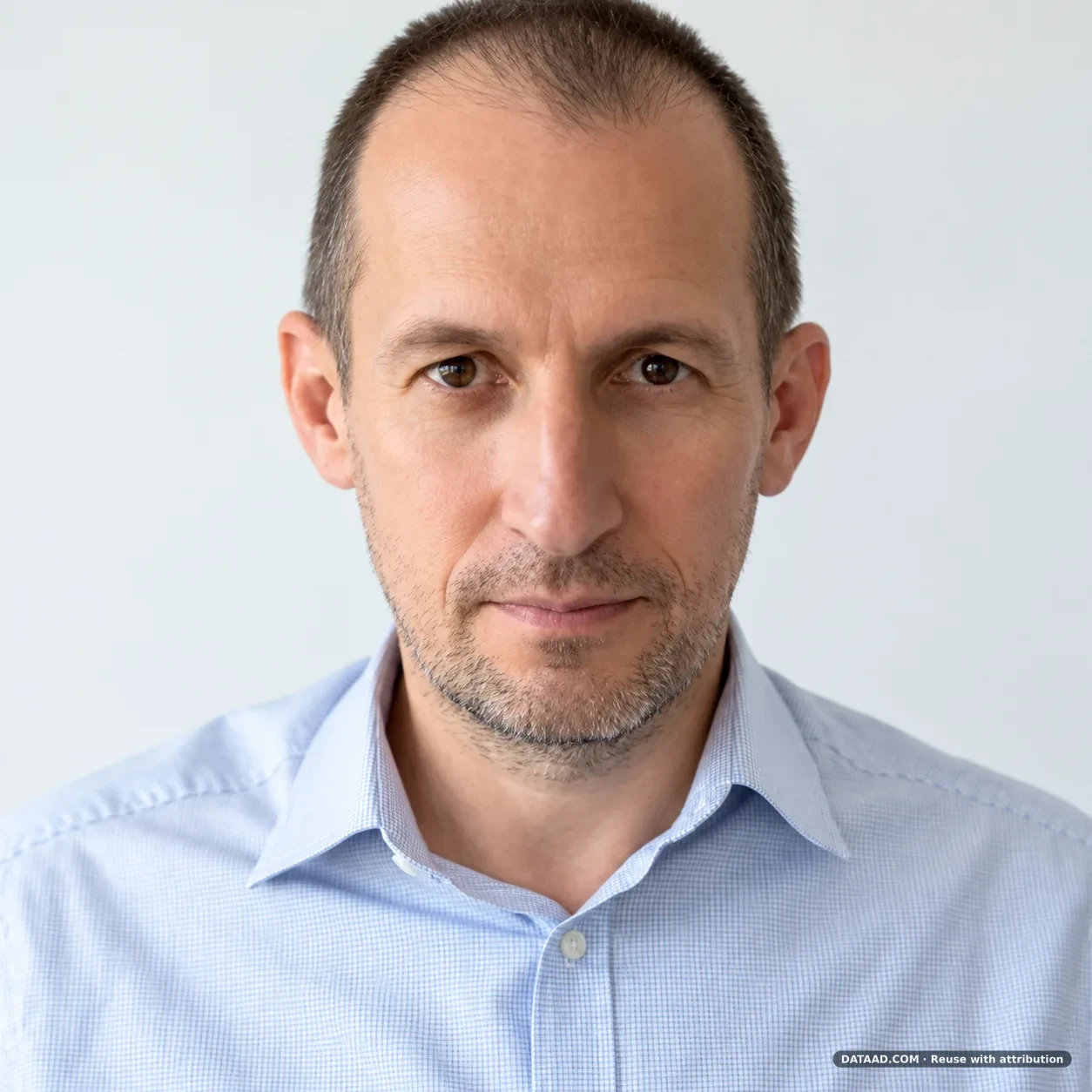
Predrag Milicevic is a navigation systems engineer specializing in unmanned and mobile platforms. His work encompasses inertial navigation, GNSS integration, sensor fusion and practical navigation-system testing.
This article is based on an exclusive email interview conducted by DATAAD in October 2026. Editorial framing and explanatory passages were prepared by DATAAD, drawing on the contributor's responses.
DATAAD Industry Voices provides a platform for independent technical experts to share their experience, perspectives and ideas with a global audience.