

DATAAD INDUSTRY VOICES | EXCLUSIVE INTERVIEW
Positioning Sovereignty: The Missing Foundation of Physical AI
Artificial intelligence is rapidly moving beyond digital environments into the physical world. Autonomous vehicles, industrial robots, unmanned vessels and intelligent infrastructure increasingly depend on machines that must understand not only their surroundings but also their precise location, movement and relationship to the physical environment.
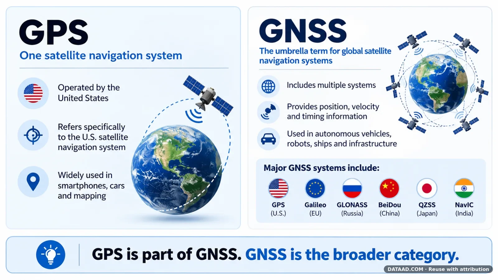
While cameras, LiDAR, radar and inertial sensors provide critical environmental information, Global Navigation Satellite Systems (GNSS) remain an important source of absolute positioning and timing.
However, the growing dependence on proprietary positioning systems raises an important strategic question: should manufacturers continue purchasing positioning technology as a black-box component, or should they develop greater control over the intellectual property and engineering capabilities behind it?
For Dr. Nikolay Mikhaylov, founder of Germany-based SoftNav GmbH, the answer lies in a concept he calls Positioning Sovereignty.
With more than 25 years of experience in GNSS technology, semiconductor development and high-precision navigation, Dr. Mikhaylov has contributed to positioning systems across automotive, aerospace, maritime and critical infrastructure applications.
In this exclusive DATAAD Industry Voices interview, he discusses the limitations of today's satellite navigation systems, the convergence of GNSS and artificial intelligence, and the emerging opportunities created by low-Earth-orbit positioning technologies.
1. Why Reliable Positioning Matters for Physical AI
DATAAD: Why is precise and reliable positioning becoming increasingly important for Physical AI and autonomous systems?
Dr. Nikolay Mikhaylov:
Artificial intelligence is transforming how machines perceive their surroundings, interpret information and make decisions. But there is a fundamental difference between intelligence operating in the digital world and intelligence acting in the physical world.
An autonomous machine must know not only what is happening around it, but also where it is, how it is moving and how its position relates to the surrounding environment.
For outdoor applications, GNSS provides a unique capability: an absolute reference to a global coordinate system.
Cameras, LiDAR and inertial sensors can determine relative positions and movements, but GNSS provides the global reference that allows these observations to be connected to maps, infrastructure and other systems.
Having worked on positioning technologies for automotive and maritime applications, I have seen how different their requirements can be.
An autonomous vehicle may need highly accurate positioning relative to road lanes and obstacles. An unmanned vessel operating in open water has very different accuracy requirements, but reliable navigation and continuous awareness of its position become critical when approaching ports or operating without human supervision.
Importantly, accuracy is only part of the story. Autonomous systems must also understand the uncertainty of their position and recognize when the information becomes unreliable.
As Physical AI expands into transportation, robotics, agriculture and maritime operations, positioning will increasingly become an integral part of the machine's decision-making process rather than simply a navigation function.
2. The Limitations of Today's GNSS Technology
DATAAD: What are the main limitations of today's GNSS technologies, particularly in challenging environments?
Dr. Nikolay Mikhaylov:
The fundamental challenge of GNSS is that receivers must extract extremely weak satellite signals from environments that are often far from ideal.
Buildings, vegetation and other obstacles can block or reflect signals. In dense urban environments, reflected signals may produce substantial positioning errors.
Intentional interference, including jamming and spoofing, introduces additional risks.
Even maritime environments, generally favorable for satellite reception, present challenges near port infrastructure, large vessels and sources of radio-frequency interference.
Modern multi-frequency receivers and precise correction services have made tremendous progress. Centimeter-level positioning is achievable under favorable conditions.
However, correction services cannot eliminate all local signal propagation errors or restore signals that are unavailable.
Another important distinction is between accuracy, availability and integrity.
A receiver may demonstrate excellent average accuracy but occasionally produce a large, undetected positioning error. For an autonomous system, such rare failures can be much more serious than the average positioning error.
From my experience developing GNSS receiver architectures and signal-processing algorithms, I would emphasize that these challenges cannot be addressed solely at the final position-calculation stage.
Receiver architecture, signal acquisition and tracking, measurement quality assessment, interference detection and navigation algorithms all contribute to the result.
There is no universally optimal GNSS receiver. Different applications require different trade-offs between performance, cost, power consumption, resilience and integrity.
This is one reason why the ability to adapt receiver technology to particular applications is becoming increasingly valuable.
3. Positioning Sovereignty: Why Ownership of GNSS IP Matters
DATAAD: Why should organizations consider developing or owning their own GNSS positioning IP?
Dr. Nikolay Mikhaylov:
I don't believe every organization needs to develop its own GNSS technology.
For many products, purchasing a commercial GNSS receiver is the most practical and economical solution.
However, the situation changes when positioning becomes a strategic capability that directly influences product performance, differentiation and competitiveness.
We can already see a broader trend toward selective vertical integration in the automotive industry. Companies such as Tesla and Rivian increasingly develop and control critical technologies, particularly in software, electronics and autonomous driving.
The objective is not necessarily to develop everything internally. It is to control the technologies that determine competitive advantage.
I believe the same principle applies to positioning.
There is no single GNSS architecture that is optimal for every application.
An autonomous vehicle manufacturer may prioritize integrity and sensor integration. A drone manufacturer may focus on power consumption, size and interference resilience. A semiconductor company may prioritize silicon area, cost and product scalability.
When organizations rely entirely on closed, third-party receivers, they largely inherit the design choices and compromises made by their suppliers.
Owning the technology gives them the freedom to make those choices themselves: to tailor the receiver to their requirements, modify its architecture and algorithms, and adapt it as their products and markets evolve.
I have experienced the value of this approach firsthand through the development and commercialization of five generations of GNSS ASICs.
A common technology foundation can support multiple generations of differentiated products targeting different market requirements.
Developing such technology from scratch is expensive and requires specialized expertise.
An alternative is to acquire proven receiver IP together with the source code, documentation and engineering know-how needed to develop an internal capability.
"This is what I call Positioning Sovereignty. It is not simply about reducing dependence on suppliers. It is about gaining the technological freedom to create better, more differentiated products."
At SoftNav, we are working to make this approach practical through transferable GNSS receiver technology and know-how.
4. GNSS, Artificial Intelligence and Sensor Fusion
DATAAD: How do you see GNSS evolving alongside AI, robotics, autonomous vehicles and unmanned vessels?
Dr. Nikolay Mikhaylov:
I expect the traditional boundaries between GNSS receivers and other navigation sensors to become increasingly blurred.
Today, GNSS is often treated as a relatively independent component delivering position, velocity and time to a higher-level navigation system.
But this approach does not fully exploit the information available from different sensors.
GNSS, inertial sensors, cameras, LiDAR and radar provide complementary information.
More advanced architectures can combine not only their calculated positions but also their underlying measurements, timing information and uncertainty estimates.
The interaction can also work in both directions.
For example, inertial measurements can support GNSS signal tracking under challenging conditions, while GNSS can constrain the accumulated errors of inertial navigation.
Vision and LiDAR can provide relative localization when satellite signals are temporarily unavailable.
AI offers additional opportunities.
Machine-learning algorithms can help identify multipath and interference, recognize challenging environments, detect anomalous measurements and adapt sensor weighting to changing conditions.
However, I do not expect AI to replace established navigation principles.
Physical models, estimation algorithms and appropriate integrity mechanisms will remain essential, particularly in safety-critical applications.
The greatest potential lies in combining the adaptability of AI with advanced signal processing and rigorous estimation methods.
For autonomous vehicles, robots and unmanned vessels, this evolution will create opportunities to develop positioning systems specifically optimized for their operating environments and functional requirements.
"The future is not about adding more independent sensors to a system. It is about designing the sensors and navigation algorithms to work together from the beginning."
5. The Next Decade: LEO-PNT and Modular Navigation Systems
DATAAD: What technological breakthroughs or market opportunities do you anticipate over the next five to ten years?
Dr. Nikolay Mikhaylov:
I believe the next major transformation in positioning will be the emergence of modular, multi-source navigation architectures.
Traditional GNSS will increasingly be complemented by new satellite navigation technologies.
Dedicated low-Earth-orbit positioning systems, such as Xona's Pulsar and ESA's Celeste initiative, are opening new possibilities.
Iridium already provides an alternative satellite-based positioning and timing service, while communication constellations such as Starlink are being investigated as potential sources of navigation signals.
These technologies differ considerably in maturity, signal characteristics and accessibility.
Nevertheless, they indicate an important direction: future positioning systems may exploit a much wider variety of satellite signals than today's GNSS receivers.
At the same time, satellite positioning will become more closely integrated with inertial navigation, cameras, LiDAR, radar and other sensors.
In principle, this creates something resembling Lego: different receiver technologies and sensors can be combined to develop solutions optimized for particular applications.
But there is a fundamental difference between connecting components and making them work together optimally.
The best performance requires control over signal processing, measurement interfaces, synchronization, sensor fusion, error models and system-level integrity.
Each technology supplier naturally optimizes its own component.
However, the optimal combined solution cannot necessarily be obtained by simply connecting products from different suppliers.
This creates an important new opportunity.
I expect the competitive advantage to increasingly shift from individual positioning components toward the technological capability to integrate, customize and continuously evolve complete navigation architectures.
Organizations that control these capabilities will be able to adopt new satellite signals, introduce new sensors and optimize their products independently of the development priorities of individual suppliers.
"The more positioning technologies become available, the more valuable it becomes to own the capability to combine them."
DATAAD Editorial Perspective
The transition from conventional navigation systems to AI-enabled autonomous machines is changing the strategic importance of positioning technology.
As Physical AI expands into industrial robotics, autonomous transportation, unmanned maritime systems and intelligent infrastructure, positioning can no longer be evaluated solely by accuracy or hardware cost.
Reliability, integrity, resilience and the ability to integrate multiple sources of navigation information are becoming equally important.
Dr. Mikhaylov's concept of Positioning Sovereignty raises a broader question for technology manufacturers: which capabilities should remain dependent on external suppliers, and which should become part of an organization's own technological foundation?
For semiconductor developers, autonomous-system manufacturers and infrastructure operators, this distinction could become increasingly important as navigation evolves toward modular, AI-assisted and multi-source architectures.
The future of Physical AI may depend not only on how intelligently machines make decisions, but also on how reliably they understand where they are.
About DATAAD Industry Voices
DATAAD Industry Voices features perspectives from researchers, engineers, entrepreneurs and technology leaders working across artificial intelligence, semiconductors, infrastructure and emerging technologies.
The series aims to encourage independent technical discussion and knowledge sharing across the global technology community.